ESA/ATG medialab,
Sentinel-1
KappaZeta
Leading the way in GIS,
SAR Remote Sensing Technology and EO
Applications.
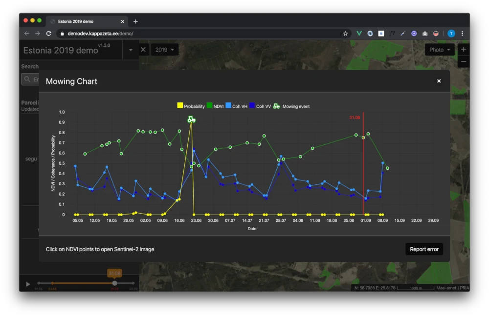
KappaZeta is an expert in Synthetic-Aperture-Radar (SAR) remote sensing technology, Geographic Information System (GIS) and innovative Earth Observation (EO) related ICT applications and services. We have been providing information based on satellite images for agricultural applications for the Government of Estonia since 2017.

Through our proprietary APIs, we deliver end-to-end solutions using our own models and classifiers. Our cutting-edge technology converts raw data from the Sentinel-1 radar satellite into time series of features valuable for machine learning, used in both scientific and industry applications. Working with other experts in the industry, KappaZeta is able to provide a comprehensive range of solutions within various industries.
KappaZeta is particularly dedicated to providing world-class radar satellite data solutions in the following sectors: EU Subsidy Checks, Agriculture, Forestry, Scientific Research, Climate Change, Insurance, Mining and Statistics. KappaZeta is also working on expanding its services into other areas that will benefit from our expertise and experience.
- EU Subsidy Checks
- Agriculture
- Forestry
- Scientific Research
- Climate Change
- Insurance
- Mining
- Statistics
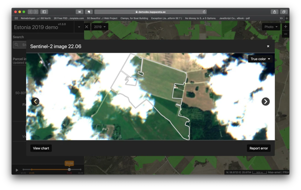
Sentinel-1 data is the only freely available data source which enable global monitoring at parcel scale with refresh rate between 3 to 12 days. We are among the very few in the world with the expertise to meaningfully utilize this data using our unique processing chain for interferometry. In comparison, optical satellites may not provide as regular and as timely data feed globally as radar satellite due to clouds interference and poor illumination.
Try now
Learn more about our API that offers analyses-ready radar timeseries here.